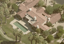
The Reveal family of products is a simple, flexible solution that improves safety, efficiency, and access to critical information.
BELLEVUE, Wash. (PRWEB)
August 31, 2020
EagleView, a leading technology provider of aerial imagery, data analytics and GIS solutions, today announced EagleView Reveal™, an enhanced product family. EagleView unmatched image detail integrates seamlessly with leading property data management systems, making it easy for municipal and county officials to make decisions from anywhere, any time.
EagleView’s extensive image library contains more than 1 billion aerial images covering 98 percent of the United States.
“EagleView understands that assessors, planners, and emergency response managers need accurate geospatial data to make the best decisions for their communities,” said Robert Locke, senior vice president of government solutions at EagleView. The Reveal family of products is a simple, flexible solution that improves safety, efficiency, and access to critical information. Reveal helps local and regional officials keep accurate property records, close revenue gaps, and respond to emergency calls for help.”
“EagleView is the best imagery solution on the market,” said Chase Fisher, GIS Manager, Jasper County, Missouri.
The Reveal product line relies on state-of-the-art, patented EagleView camera systems that uniquely capture top down (orthogonal) and angled (oblique) images. This information enables assessors, planners and other emergency personnel to make the best decisions quickly from the safety of a desktop or a mobile app.
“When a property changes from new construction, demolition, or natural disaster, EagleView customers know right away,” said Locke. “While some counties and municipalities use satellite imagery to view land and infrastructure, EagleView customers see images that are up to 70 times sharper than satellite images and 4 times more detailed than standard aerial images. That means a first responder can tell the difference between a trampoline and covered pool, which can be a life-or-death situation after dark.”
EagleView Reveal offers choices so counties and municipalities can find the right solution for their needs and budget. Each package allows a choice in the degree of imagery resolution, and additional features may be added.
-
Essentials: Provides a foundational understanding of properties, land features, and local topography, offering an excellent baseline for making planning decisions - Essentials+: Produces a 360-degree view of every property using imagery captured from four simultaneous directions, providing a deeper understanding of properties, land, and resources
- Advanced: Includes visual touch-ups and four-band color infra-red that reveals details the naked eye cannot see, providing every detail needed to plan, respond, and allocate resources
EagleView serves more than half of the 3,143 counties in the U.S. by seamlessly integrating with property data systems. Collectively, EagleView customers have identified hundreds of millions in property value not previously in their property records.
EagleView imagery informs public safety systems, including 911 systems, ensuring updated mapping of access and egress points from properties, utility equipment, and natural features such as waterways and firebreaks. Many other industries, including utilities, natural resource management, urban planning, and real-estate development also use EagleView’s precise imagery to make plans and allocate resources.
About EagleView
EagleView is a leader in aerial imagery, machine learning-derived data analytics and software, helping customers in different industries use property insights for smarter planning, building and living. With more than 200 patents, EagleView pioneered the field of aerial property measurements and has the largest multi-modal image database in history, covering 98 percent of the U.S. population. Flying over 9.5 million linear miles every year, EagleView’s coverage is the most extensive and up to date, enabling local government and business customers to use the most accurate data to make timely and informed decisions. For more information, call (866) 659-8439, visit http://www.eagleview.com and follow @EagleViewTech.
Share article on social media or email:

